Muscat’s mix of ancient alleyways and modern boulevards can overwhelm visitors. My first time there, I struggled to find my way from the historic harbor to the commercial districts with just a simple map of Muscat.
This Muscat Oman Map will help you become skilled at exploring Muscat, Oman’s beautiful capital. Our detailed Muscat Oman map guide shows you how to navigate the winding streets of Old Muscat and find quick routes to modern business districts.
In this piece, you’ll discover Muscat’s geographic layout, navigation tools, and district-specific tips. You’ll learn about transportation options and get practical tips to explore this fascinating city confidently. The guide covers everything from historic quarters to contemporary neighborhoods.
Understanding Muscat’s Geographic Layout
Muscat’s geography tells an amazing story. The city stretches along a beautiful 100km coastline between the Arabian Sea and the Hajar Mountains. The city’s structure might look complex at first glance, but you’ll find it quite easy to direct yourself once you understand its layout.
Major Districts and Their Characteristics
The city follows a linear pattern along the coast. Muscat divides naturally into three main zones:
| Zone |
Key Districts |
Notable Features |
| West Muscat |
Al-Seeb, Bawsher |
Modern residential areas, airport vicinity |
| Central Muscat |
Al-Khuwair, Qurm |
Commercial hub, diplomatic quarter |
| East Muscat |
Muttrah, Old Muscat |
Historic center, traditional architecture |
 Natural Landmarks and Orientation Points
The city’s distinctive natural features make excellent reference points:
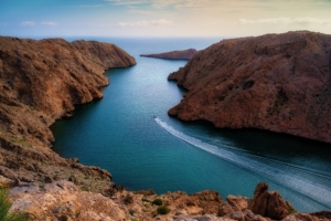
- The Central Hajar Mountains create a dramatic backdrop along the northern coastline
- The Gulf of Oman coastline with its two natural harbors at Muttrah and Muscat
- The volcanic hills surrounding the waterfront, which contrast beautifully with the white buildings
Key Transportation Arteries
Sultan Qaboos Street runs as Muscat’s main artery from west to east through the city. It becomes Al Nahdah Street near Al Wattayah and creates a vital transportation corridor. The Muscat Expressway connects Al Qurum to Halban across 54 kilometers and provides another crucial route through the metropolitan area.
The city has grown compactly. Population densities increase in areas with good connections. This design makes it easier to move between the 19 employment clusters that shape Muscat’s urban landscape.
Essential Navigation Tools and Resources
Getting around Muscat is much easier if you have the right navigation tools. Let me share some digital solutions that worked great for us as we learned about this beautiful city.
 Digital Mapping Applications for Muscat
Google Maps works reliably for navigating Muscat’s urban areas. It gives accurate directions for driving and walking routes in the city center. The best part is that you can download maps to use offline – this helps a lot in areas with poor mobile signal.
Local Navigation Apps and Services
We tested several local apps to find out what works best. Here’s how they stack up:
| App Name |
Best For |
Key Features |
| OTaxi |
Local rides |
Professional drivers, transparent pricing |
| Mwasalat |
Public transit |
Live bus tracking, route planning |
| Pinch. om |
Tourism |
242+ destinations, detailed route info |
Offline Navigation Solutions
These offline solutions help us a lot in areas with limited connectivity:
-
- Works great in rural locations
-
- Detailed offline country maps
-
- Great for hiking and off-road adventures
Waze gives us the most current traffic updates in Muscat, especially during rush hour. It helps us navigate through newer developments and tricky roundabouts that might confuse other navigation apps.
The National Survey Authority’s digital maps are a great choice for complete offline navigation. You should download them before your trip. These official maps cover both urban and rural areas well, so you won’t get lost even without internet.
Note that it’s smart to keep multiple navigation options ready – each one serves a different purpose as you explore Muscat.
District-by-District Navigation Guide
The sort of thing I love about Muscat is how each district presents its own unique way to get around. Let’s take a look at the navigation challenges and solutions we found in every part of this amazing city.
Old Muscat and Historical Areas
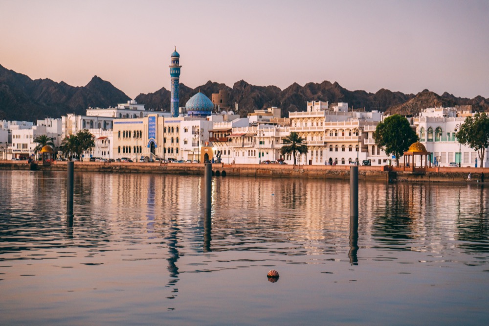
Getting around Old Muscat needs a different approach than modern GPS systems. The area near Al Alam Palace is our main reference point, and the twin Portuguese forts of Al-Jalali and Al-Mirani stand out as clear landmarks. The Corniche serves as our orientation line when we explore Muttrah, and it leads naturally to the famous Muttrah Souq.
Modern Commercial Districts
Qurum Commercial District’s changes have brought new navigation markers. The area has become a bustling hub of shopping and entertainment. Modern landscaping and lighting make evening navigation easy. Here’s our breakdown of the commercial zones:
| District |
Main Landmarks |
Best Access Routes |
| Qurum |
Shopping Centers, Parks |
Sultan Qaboos Highway |
| Al Khuwair |
Government Offices, Cafes |
Muscat Expressway |
| Ruwi |
Business Centers, Markets |
November 18th Street |
Residential Neighborhoods
Each neighborhood in Muscat has its unique character. Bousher connects easily to main roads and commercial centers. Al Mawaleh stands out with its modern complexes and recreational facilities. These key landmarks help us navigate:
- International schools and universities
- Major shopping malls and supermarkets
- Prominent mosques and community centers
- Public parks and sports facilities
A mix of digital maps and physical landmarks works best to navigate residential areas. Some newer developments might not show up on older navigation systems.
Transportation Options and Routes
Moving around Muscat is now easier than ever with plenty of transport choices. We spent time in the city and put together the quickest ways to get from place to place.
Public Bus Network and Routes
The Mwasalat bus service works great and won’t break the bank. The network runs on 3 zones.
Route A1 links Ruwi Bus Station to Muscat International Airport and runs all day with buses every 30 minutes. Route 4 is our top pick because it stops at popular spots like Muttrah Souq and the National Museum.
Taxi Services and Ride-Hailing Apps
Local taxi services vary quite a bit in terms of convenience and cost:
| Service Type |
Features |
Best For |
| Mwasalat Taxi |
Metered, government-regulated |
Airport transfers |
| OTaxi |
App-based, transparent pricing |
City travel |
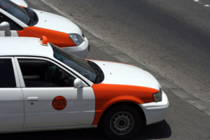
| Traditional Taxis |
Orange-white, negotiable rates |
Short distances |
 Walking and Cycling Routes
Muscat isn’t the easiest city to walk around, but there are some great spots to explore on foot. The Muttrah Corniche and Old Muscat areas stand out with their well-laid-out walking paths.
Cyclists can enjoy several routes based on their experience level. The coastal roads offer beautiful views, but it’s best to ride early morning or evening to beat the heat. The paved paths work well for both casual riders and serious cyclists.
Conclusion
Muscat might seem overwhelming at first, but the city’s linear coastal layout and distinct districts become easy to navigate over time. Our experience shows that Google Maps, combined with traditional landmarks, is the quickest way to find your way around this amazing city.
The best way to start your Muscat trip is in the historic districts. Use the Corniche as your reference point before you head to the modern commercial areas. The city is easy to get around in with several options. Mwasalat buses run efficiently, and ride-hailing apps are simple to use, making the whole experience budget-friendly. Early mornings are perfect to walk or cycle along the beautiful coastal routes.
Each of Muscat’s districts has its own story to tell. The winding alleys of Muttrah Souq contrast beautifully with Qurum’s modern boulevards. These navigation tips and local insights will turn your time in Oman’s capital into an exciting adventure instead of a challenge.
Create memories in Muscat that last forever. Book Now!